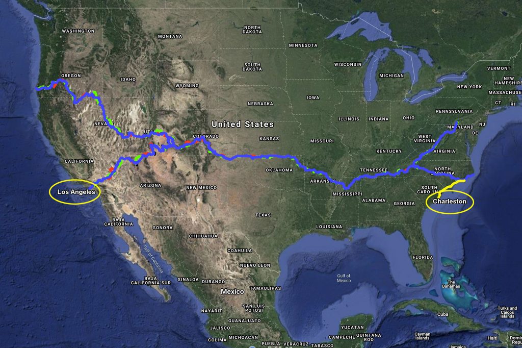
The Trans-America Trail is a patchwork of fire roads, farm roads, dirt trails, and scenic byways that transects America from the Atlantic coast in the east, to the Pacific coast in the west. Maps of the Trans-America Trail can be found by Sam Carrero at www.transamtrail.com and by GPS Kevin at www.gpskevinadventurerides.com. Here’s a map of the route we took from Charleston to Los Angeles:
Joining me on this journey are my good friends Jason Bennett of www.docentprodigy.com and Steve Roos of www.ashcraftstudio.com. As always, you can find me at www.chrisandcami.com. Having three photographers on one trip could be interesting! How many times would we have to stop to “get that shot”? Would we ever make it to our destination?!? I’ll be doing the bulk of the filming along the way. As with our Moto Photo Mexico trip, Jason will be using his mad skills as the video editor for the Moto Photo TAT. If you haven’t seen it yet, check out that adventure down through Mexico at: https://tinyurl.com/y9mvyzgv. Steve will be providing his photography skills, as well as his larger-than-life personality and fun sense of humor for comedic relief!
Get started today by clicking the link below:
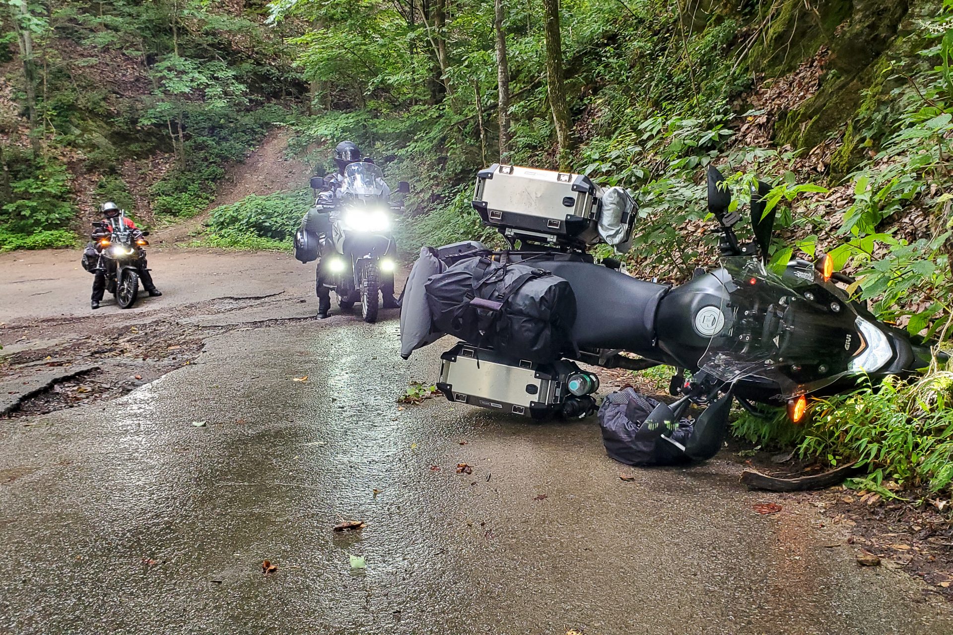
We hope you’ll join us and follow along on this incredible journey of discovery as we experience the REAL America through the selfless kindness of strangers, the struggles of flat tires and dropped bikes, the breathtaking views of high mountain passes, and the ultimate freedom of the open trail!
We’d also love your questions, travel tips, and suggestions on what great adventure we should tackle next. Just leave them in the comments below each episode on YouTube. While you’re there, please help us out by giving each video a “Thumbs Up”, clicking the Bell icon to receive notifications, and Subscribing to the channel. Thanks for joining us on this epic adventure!!! 🙂